Google Earth Pro 4.2.205.5730

Google Earth Pro is a mapping application that allows you to explore the world
3.9 
Rating
Your vote:
Latest version:
7.3.6 See all
Developer:
Screenshots
1 / 8
Awards (3)
Show all awards
Software Informer Editor Rating 5
Download

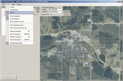
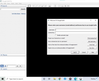
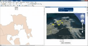
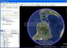
Google Earth Pro is an incredible mapping application that will allow you to fly through a global database of Earth imagery and detailed mapping information. This program allows you to take a 7-day trip to any area on Earth, including many high-resolution cities in the United States, and some select cities abroad. With this program you will be able to see streets, cities, monuments ant "travel" from one city to another in a few seconds, and much more. Among the new features, Google Earth Pro allows users to see GPS data from GPS devices or in file formats such as .gpx or .loc, it includes new functions such as "draw a path" o "draw a polygon" and allows you to "geocode" street addresses by importing a .csv format file. Moreover, it features broader capabilities than Earth Plus for importing spreadsheet data and for printing in a higher resolution. It also adds the ability to measure areas and can be extended with a variety of optional modules, such as the "movie making" module. Major US cities have 3D building models. These aren't turned on by default, and they look a little like matchboxes, since they're not detailed recreations. With this version you can also explore the sky, export high-resolution images and use them in documents, presentations and the web. Google Earth Pro is only recommendable for professional and commercial purposes.

SM Senior editor
Silvana Mansilla
Editor rating:
rating

Review summary

Pros

  • Huge database of useful information
  • Highly detailed satellite images
  • Ability to Export high resolution images

Cons

  • Some images are blurry outside the U.S
  • Needs a lot of system requirements

Comments (13)

3.9
Rating
487 votes
5 stars
282
4 stars
59
3 stars
43
2 stars
32
1 stars
71
User

Your vote:

G
rating Greg N.
Historical imagery control tab gone, which was VERY helpful for showing various development over time, with specific mo/yr dates, recent building demolition, or to find winter images when tree cover (foliage) doesn't block view of buildings or topography.

Total fail - an update that has lost what real estate people need most.

4 months ago Was it helpful?  yes(0) no(0) | Reply
S
rating sambhaji gawade
No past history such as 1999.

5 months ago Was it helpful?  yes(1) no(0) | Reply
C
rating Cianna Williams
This is awesome for kids to learn all about Earth!

Nov 16, 2022 Was it helpful?  yes(1) no(1) | Reply

Related software

Arc2Google
Arc2Google
Free
rating

This tool, Arc2Google, combines ArcMap with Google Maps And Google Earth.

Earth Bridge
Earth Bridge
Free
rating

Is designed to bridge the gap between Google Earth and your GPS receiver.

Google Earth Connections AC16 INT
Google Earth Connections AC16
Free
rating

ArchiCAD users can publish their designs to the world.

AquaSoft Earth Pilot
rating

With Earth Pilot you can fly free handedly and without a pilot's license.

MSR MapCruncher for Virtual Earth
MSR MapCruncher for Virtual
Free
rating

A tool for integrating the maps of your choice into the Virtual Earth API.

Related suggestions

Google map earth beta 5.0.jar
World map download
Nokia 500 gps update
Google earth exe
3gp map download
Nokia 500 software update
World map free download
World map 2013 free download for pc
World map pc software